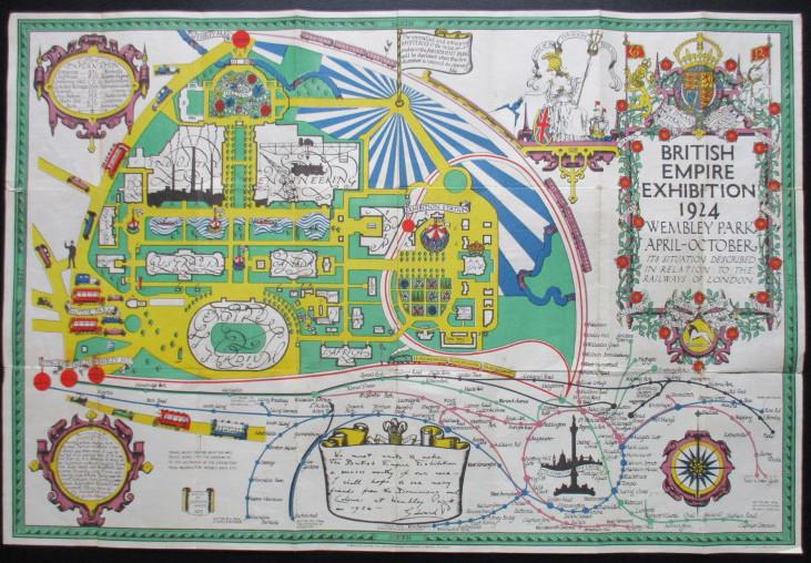
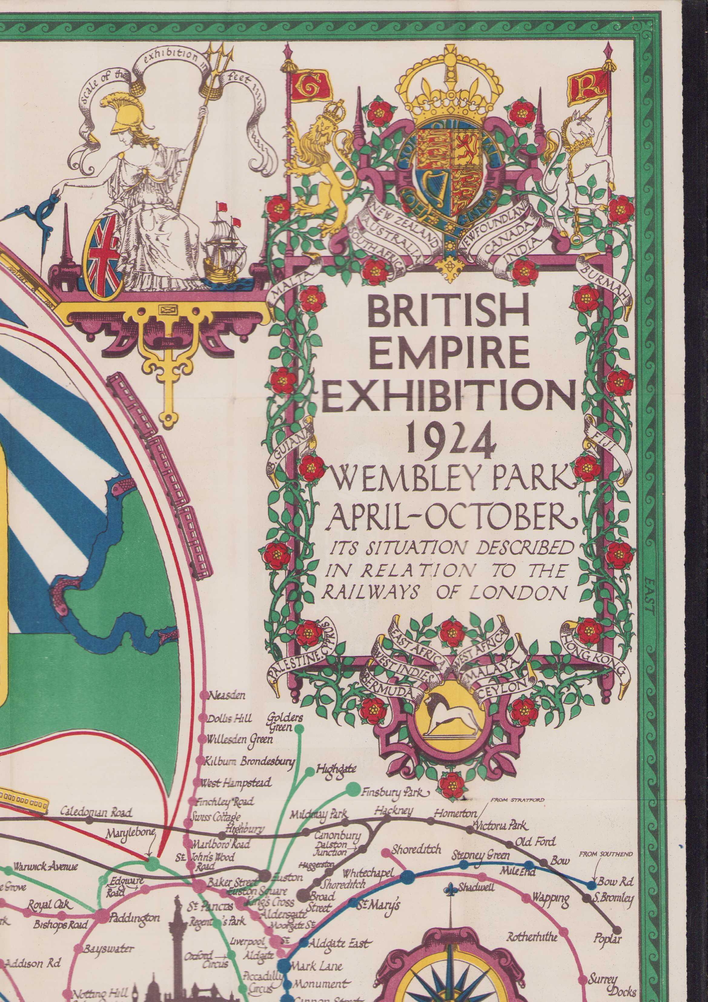
British Empire Exhibition 1924 - Wembley Park April-October its situation described in relation to the Railkways of London
Stanley Kennedy North (1887-1942), has drawn upon a number of cartographic influences, including strapwork cartouches reminicent of the first county maps by C
ISBN:
Jaar:
1924
Kwaliteit:
Zeer goed
Uitgever:
British Empire Exhibition 1924
Beschrijving:
Folded map in 24 segments with text on verso. 73x50,5Cm.
Inhoudelijke beschrijving:
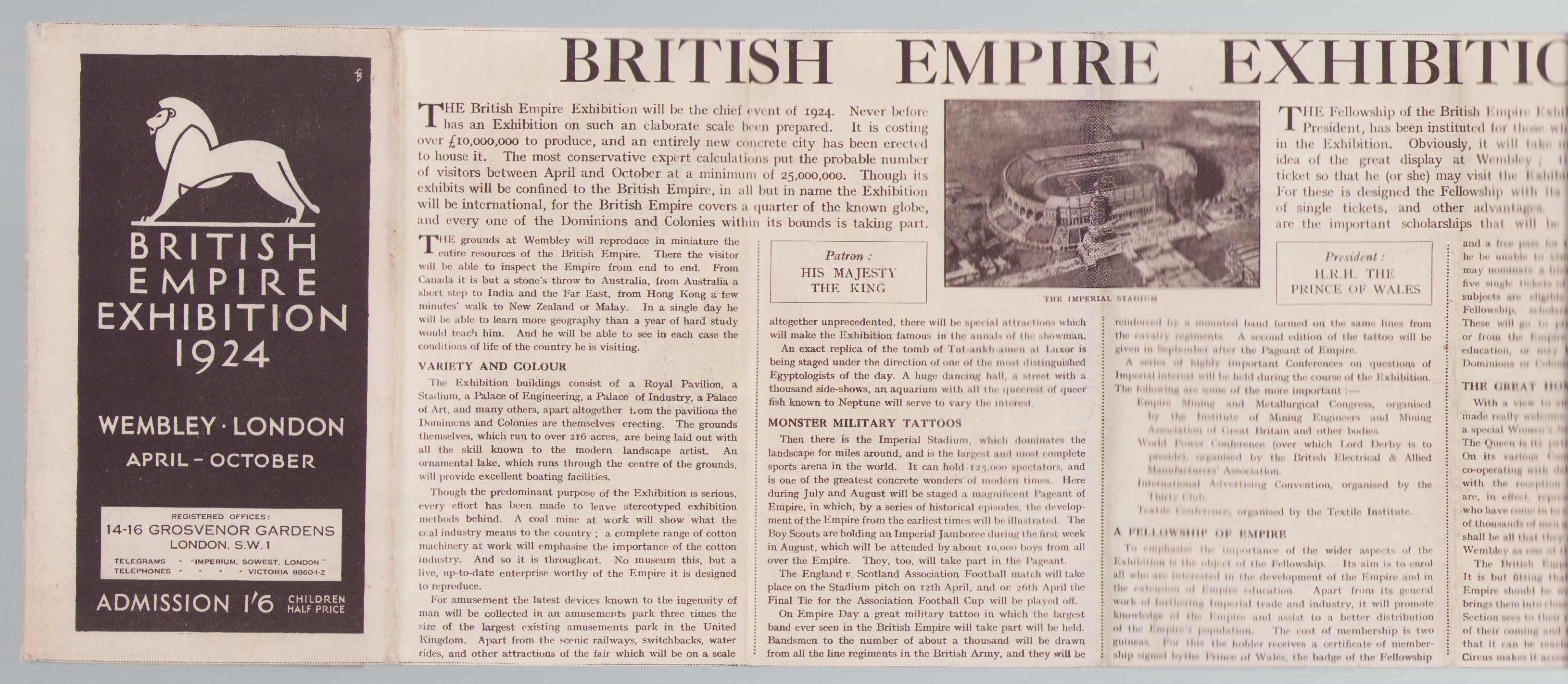
Decorative British Empire Exhibition guide, prepared for 1924 exhibition at Wembley in North London.
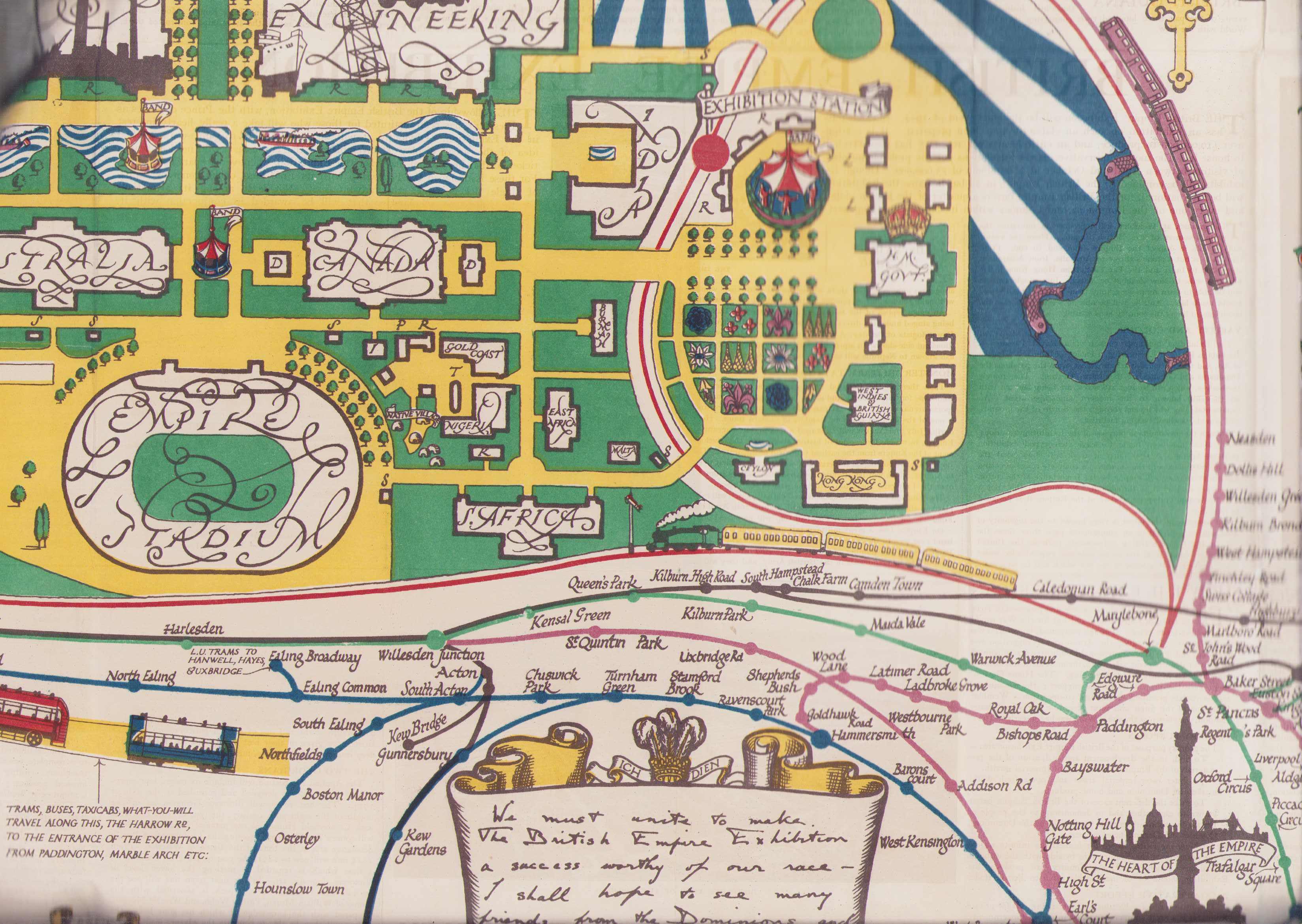
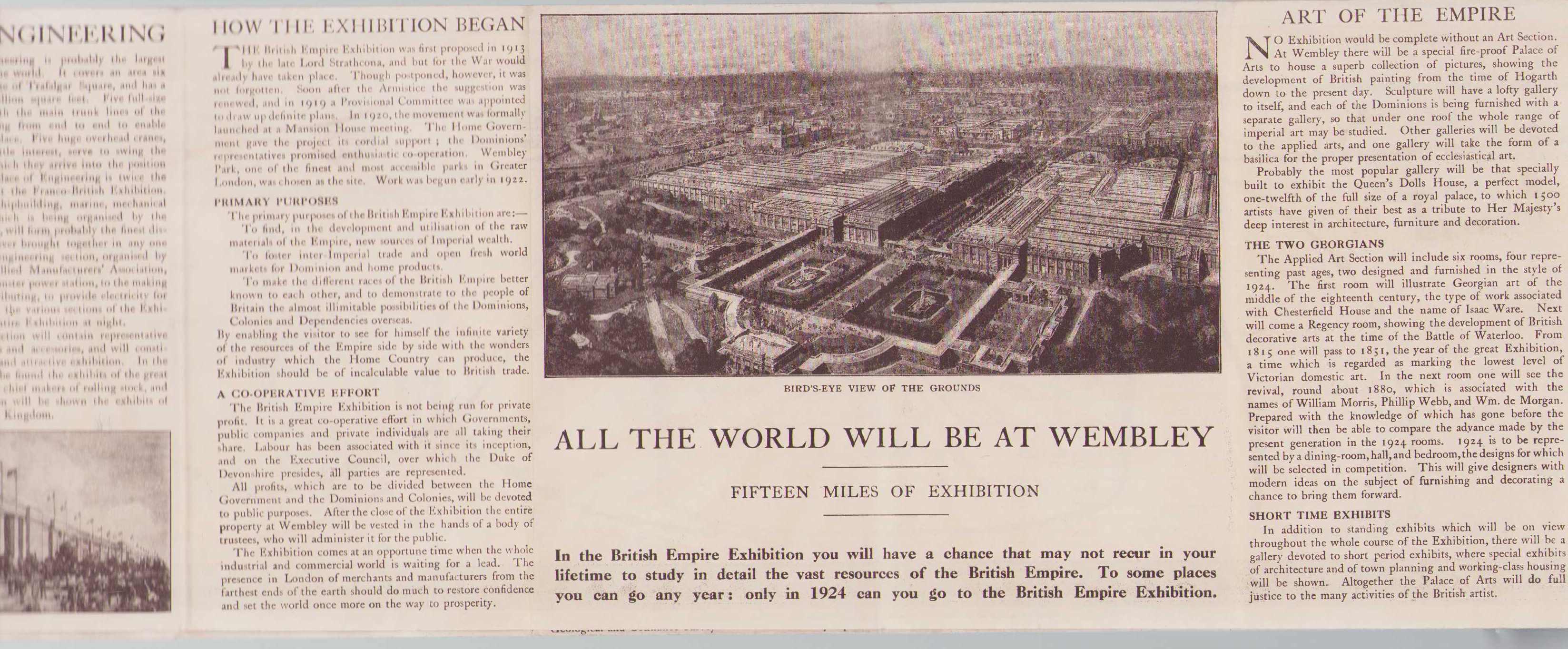
A pictorial map of the layout of the British Empire Exhibition at Wembley Park in 1924, a swansong for the Empire as it was morphing into the British Commonwealth.
The original Wembley Stadium was built for this event and opened in 1923. The oval is clearly visible, underneath two large areas marked 'Industy' and 'Engineering' and large pavilions for Australia, India & Canada, and smaller ones for other nations, including New Zealand, East Africa, Malay, Burma, Hong Kong & Malta.
Underneath is a diagramatic map of the rail links to Wembley via the lines that are now London Underground, with a circular 'Circle Line' surrounding a silhouette of Nelson's Column against the London skyline. On the reverse are guides to the pavilions, with a note 'With the Compliments of the Sheffield Daily Telegraph', showing this printing was for the Yorkshire region.
The mapmaker, Stanley Kenne
Specifieke beschrijving: